Pianoro

Subject: Villages and Settlements
Toponym: Querceto di Gorgognano
Type: Settlement
Municipality: Pianoro
Locality: Querceto di Gorgognano
Description
This place experienced many vicissitudes, as revealed by historical documents and topographical maps of different periods.
In the 17th century the site was divided into two settlements, Gorgognano di Sopra ("above") and Gorgognano di Sotto ("below") (source: Dizionario orografico - S. Calindri - 1781 Arnaldo Forni editore): the former, associated with the presence of an old castle, as well as a church documented on an IGM (Military Geographic Institute) map, was situated, up to the end of the 19th century or early years of the 20th, on the small ridge that runs alongside the road, with the name of Gorgognano; two buildings can now be found there.
The latter, named Poggiolo, was on the site now called Querceto di Gorgognano on the Regional Technical Map.
These places, too, were probably devastated by the bombing along the Gothic Line.
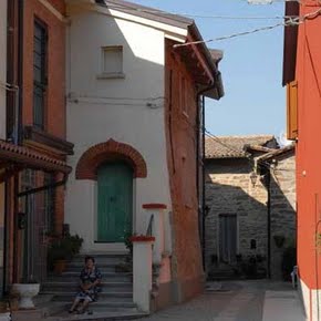
Various buildings retain their original features and few modifications unsuited to the context have been made, particularly as regards the exterior plasterwork and colours.

